Mapbox Polygon
This node should be placed as a child in the Mapbox Map node, it can be used in a repeater.
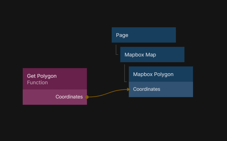
Here is the code that is inside the "Get Polygon" Function node:
Outputs.Coordinates = [
  [
    [-118.446802, 34.061877],
    [-118.456802, 34.061877],
    [-118.456802, 34.051877],
    [-118.446802, 34.051877],
    [-118.446802, 34.061877],
  ],
];
Inputs
| Data | Description |
|---|---|
| Coordinates | Sets the current coordinates. |
| Enabled | Enable / Disable user interaction. |
| Signal | Description |
|---|---|
| Edit | Send a signal to start polygon editing. |
Outputs
| Data | Description |
|---|---|
| Mapbox Object | The mapbox object. |
| Mapbox Draw Object | The mapbox draw object. |
| Feature Id | The feature id. |
| Coordinates | The coordinates of the polygon. |
| Signal | Description |
|---|---|
| Updated | Sends a signal when the polygon is getting updated. |
| Selected | Sends a signal when the polygon is getting selected. |
| Unselected | Sends a signal when the polygon is unselected. |
| Did Mount | Sends a signal when the polygon is loaded. |
| Will Unmount | Sends a signal when the polygon is unloaded. |