Geospatial Center
Takes a GeoJSON feature and returns the absolute center point.
Here is an example of how to use it.
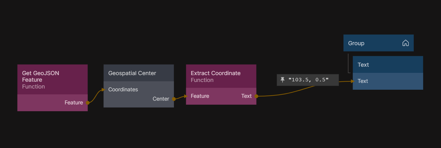
This is what is inside the "Get GeoJSON Feature" funciton node:
Outputs.Feature = {
  type: "Feature",
  geometry: {
    type: "LineString",
    coordinates: [
      [102.0, 0.0],
      [103.0, 1.0],
      [104.0, 0.0],
      [105.0, 1.0],
    ],
  },
};
This is what is inside the "Extract Coordinate" function node:
const feature = Inputs.Feature;
const coordinate = feature.geometry.coordinates;
Outputs.Text = `${coordinate[0]}, ${coordinate[1]}`;
Inputs
| Data | Description |
|---|---|
| Coordinates | The GeoJSON feature. |
Outputs
| Data | Description |
|---|---|
| Center | A GeoJSON feature with the center position. |
| Signal | Description |
|---|---|
| Changed | Occurs when the Center output is updated. |